19th Cent. French walled city plans - 1816 to 1845
- 20 hours
- 44 views
- Riverstown, Co. Sligo
Description
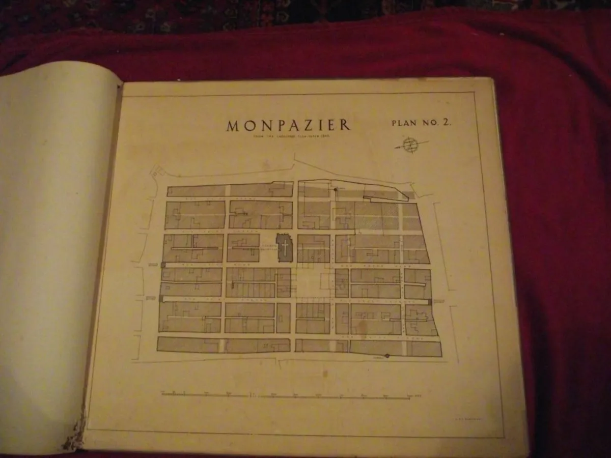
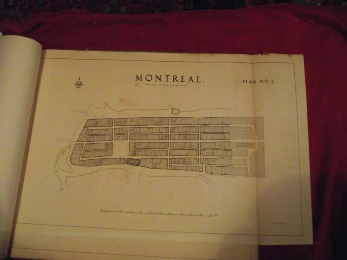
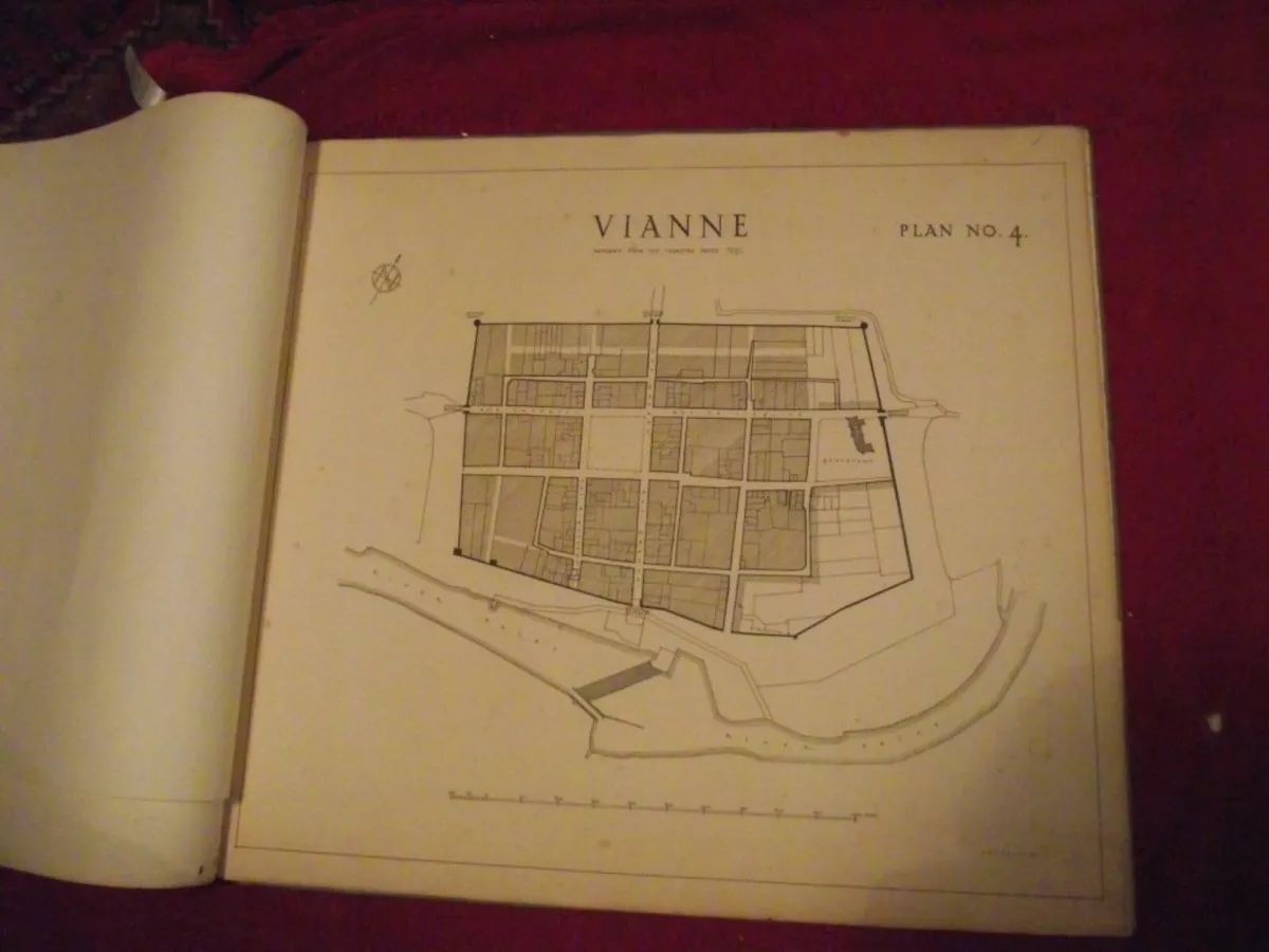
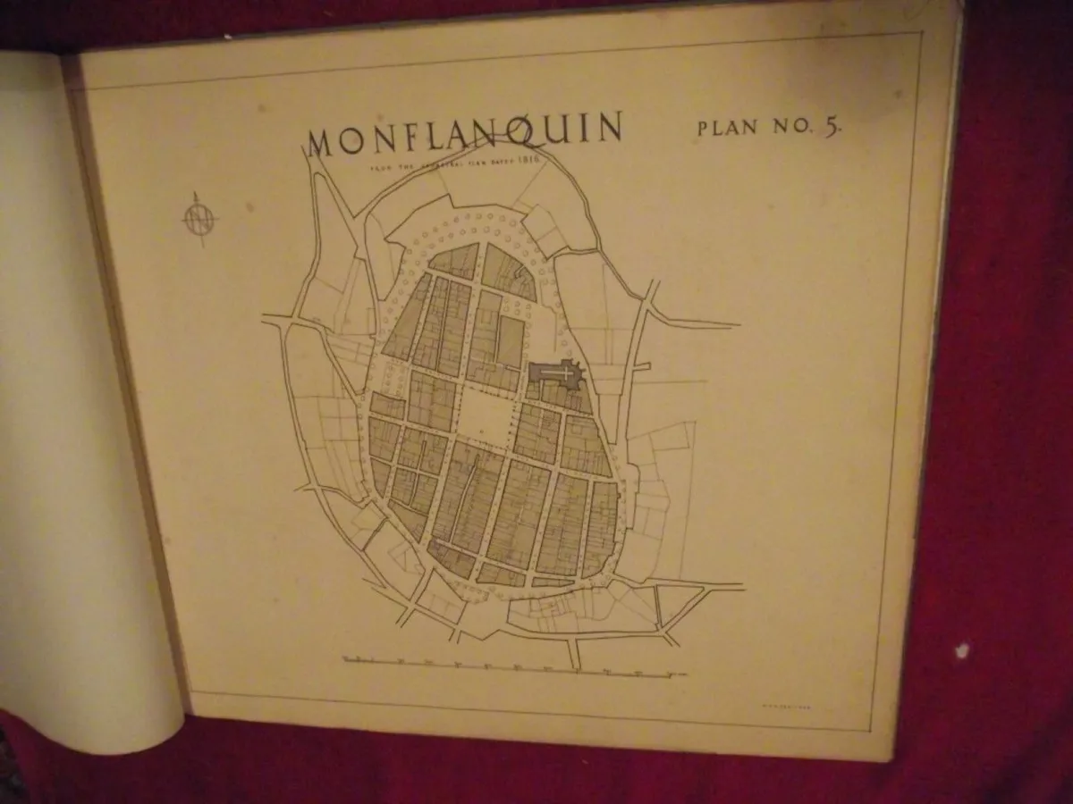
8 X 19th Century French walled city plans in a portfolio by G. H. Heritage Eight French City Plans, each has the City name and underneath each is printed "From the Cadastral Plan" and dated - see details below. 1. Saint Livrade - 1836 2. Monpazier - 1845 3. Montreal - (not dated) 4. Vianne - 1837 5. Monflanquinn - 1816 6. Monsegur - 1835 7. Saint Clar - 1833 8. Villeneuve Sur Lot - 1826 Condition: wear to portfolio but still firm - map No.1 has insect damage to top and bottom left corners (mainly margin) - map No.8 has small closed tear to left margin near bottom - all maps show some wear with the thick paper age toned - the name "G.H. Heritage" is printed on all maps to the bottom right corner - there is a small label on the inside of the portfolio showing the name of the stationers who supplied the folio for the maps - see all images. Dimensions: Portfolio covers: 24 3/4" wide x 21 1/2" high 6 x maps 23 5/8" wide x 21" high 1 x map 28 3/4" wide x 19" high 1 x map 32 1/4" wide x 28 3/4" high An interesting collection of 19th century French maps that would look great framed.
![[object Object] image](https://statics.donedeal.ie/dist-marketplace-frontend-donedeal/2025.6.9-145654.production/spassets/images/illustrations/profile-new.svg)
Pat
- Private Seller
- Riverstown, Sligo
Email, Phone
Excellent
Reviews
2 years
on DoneDeal
DoneDeal Rating
5.0/5
124 Reviews- Easy to deal with•54
- Good communication•32
- Quick response•24
- Item as described•23
- Smooth process•22
- Great value•3
- Prompt collection•1
Find out how we are keeping you safe.
Learn MoreYou may also like
- Similar items in your price range
- 1 / 10
2 x Mid 19th Cent. Engravings by Cruikshank
- 20 hours
- Riverstown, Co. Sligo
- 1 / 6
French wall cabinet
- 13 days
- Sligo Town, Co. Sligo
- 1 / 6
19th century French 3 piece suite
- 21 hours
- Lifford, Co. Donegal
- 1 / 10
19th Century Staffordshire Pottery Quill Holder
- 21 hours
- Riverstown, Co. Sligo
- 1 / 10
19th century french table
- 3 days
- Ennis, Co. Clare
- 1 / 4
19th century french chair
- 16 days
- Limerick City, Co. Limerick


Legal
DoneDeal.ie is not responsible for the advertised goods. It is illegal to use the contact information for commercial purposes.
Tips and Guides
- Safety Guide
- Be informed, read our advice if you get unwanted calls