German Military Maps of Ireland during World War 2
- 6 days
- 104 views
- Navan, Co. Meath
Description
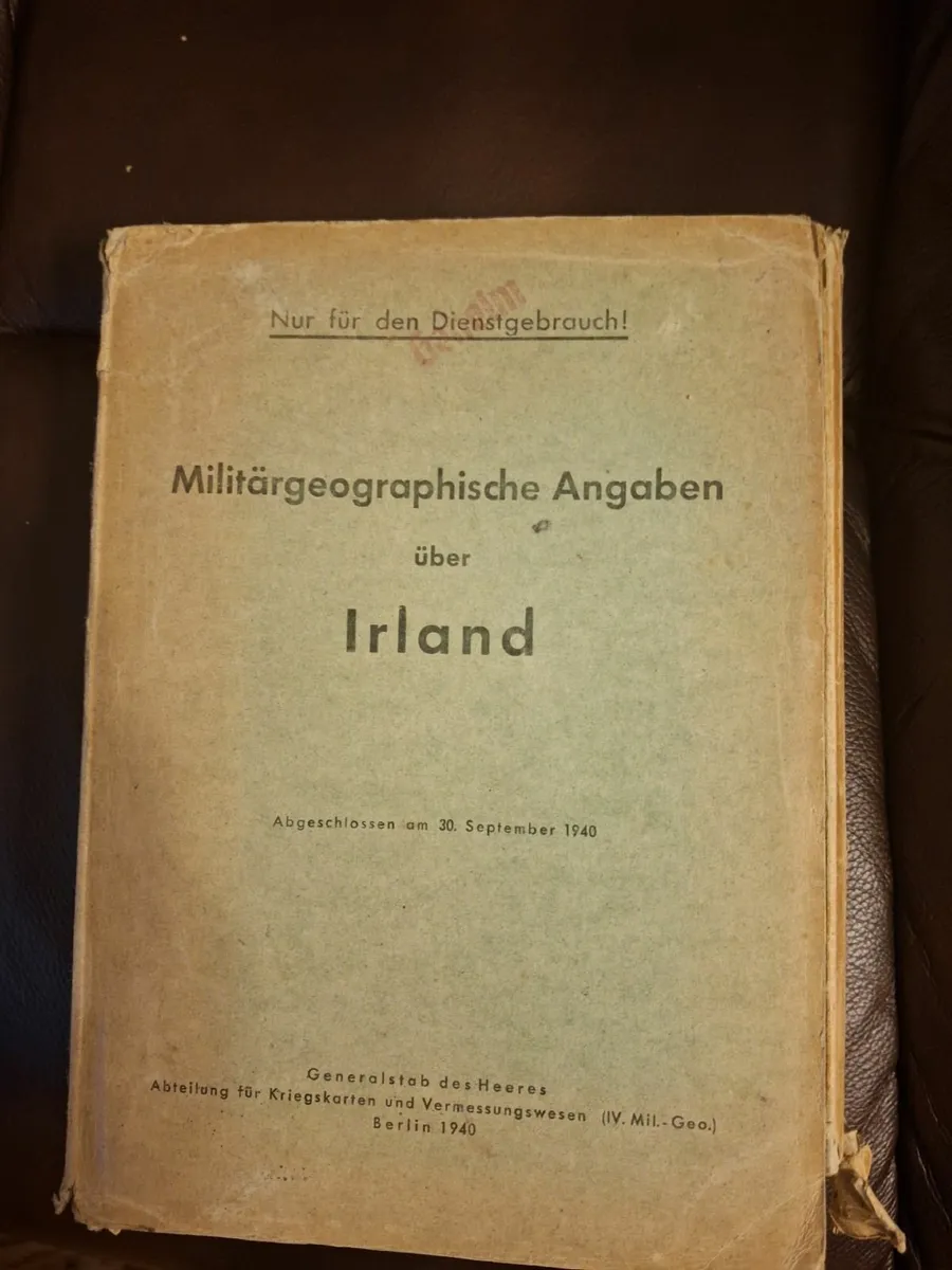
The wallet of books and maps is marked 'For Official Use Only !' There are 10 maps covering the whole of Ireland showing the Ports, Railways, Street names etc. The book is written in German, the photos are described in both German and English and all the large fold-up maps are in English. This wallet was published on 30th September 1940.
![[object Object] image](https://statics.donedeal.ie/dist-marketplace-frontend-donedeal/2025.9.5-85920.production/spassets/images/illustrations/profile-new.svg)
jack
- Private Seller
- Navan, Meath
Phone
No rating
0
No reviews yet
17 years
on DoneDeal
DoneDeal Rating
This seller does not have a rating yet.
Find out how we are keeping you safe.
Learn MoreYou may also like
- Similar items in your price range
- 1 / 1
World Book complete 1987
- 6 days
- Dunboyne, Co. Meath
- 1 / 4
World Book Encyclopedia Collection
- 3 days
- Hollystown, Co. Dublin
- 1 / 3
Seven World War Books
- 24 days
- Mayo, Co. Mayo
- 1 / 6
My World Is Built
- 4 days
- Co. Dublin
- 1 / 2
Full Encyclopedia Set of World Books & Children's
- 22 days
- Douglas, Co. Cork
- 1 / 9
Dance music of ireland, O Neills
- 29 days
- Ballysimon, Co. Limerick


Legal
DoneDeal.ie is not responsible for the advertised goods. It is illegal to use the contact information for commercial purposes.
Tips and Guides
- Safety Guide
- Be informed, read our advice if you get unwanted calls